
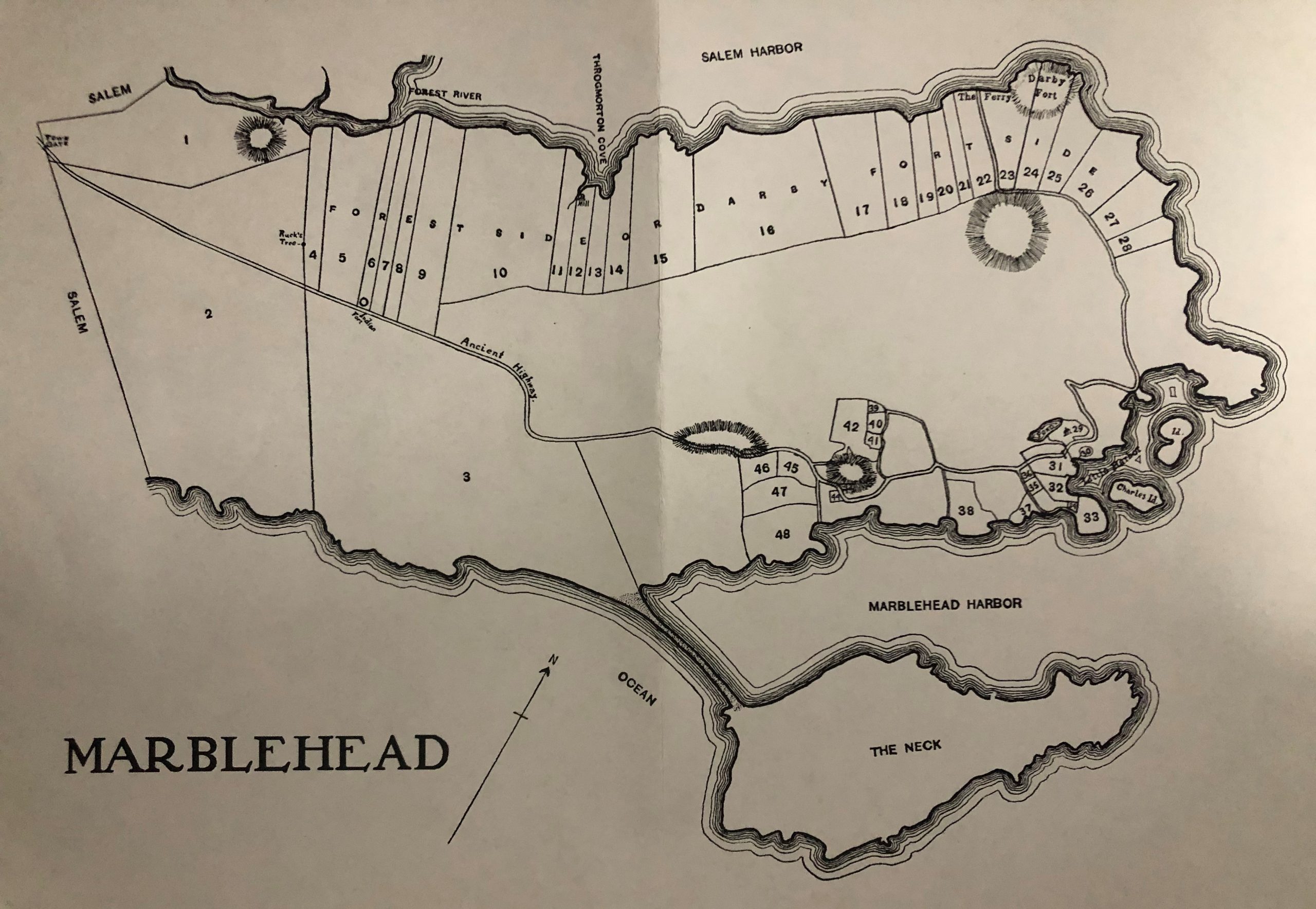
“Marblehead in 1649.” An Excerpt from History of Salem by Sidney Perley. With Map. A short history including land information.

Marblehead in the Year 1700 and Sectional Maps and Composite Map. Sidney Perley, 1910. A compiled history based on public records, including deeds, wills, probate, court, legislative, and miscellaneous town records.

“Plan of Marblehead, Mass. From Actual Survey by Henry McIntyre, 1850.” Showing the locations and owners of most buildings in town.

Map of Marblehead, 1872, with “Business Directory.” Showing the locations and owners of many buildings in town.

D.G. Beers & Co., 1872 Map of Marblehead

Plan of Marblehead by John G. Hales, 1830.

Plan of Marblehead by William Bentley, c.1800 from Harvard University

Plan of Marblehead by Alfred Ingalls, October 1795.

Southern Essex County Land Records. Online site with deeds searchable (via Index Books tab) back to 1629.

Marblehead Directories. Listings of residences and businesses, along with advertisements and town information.

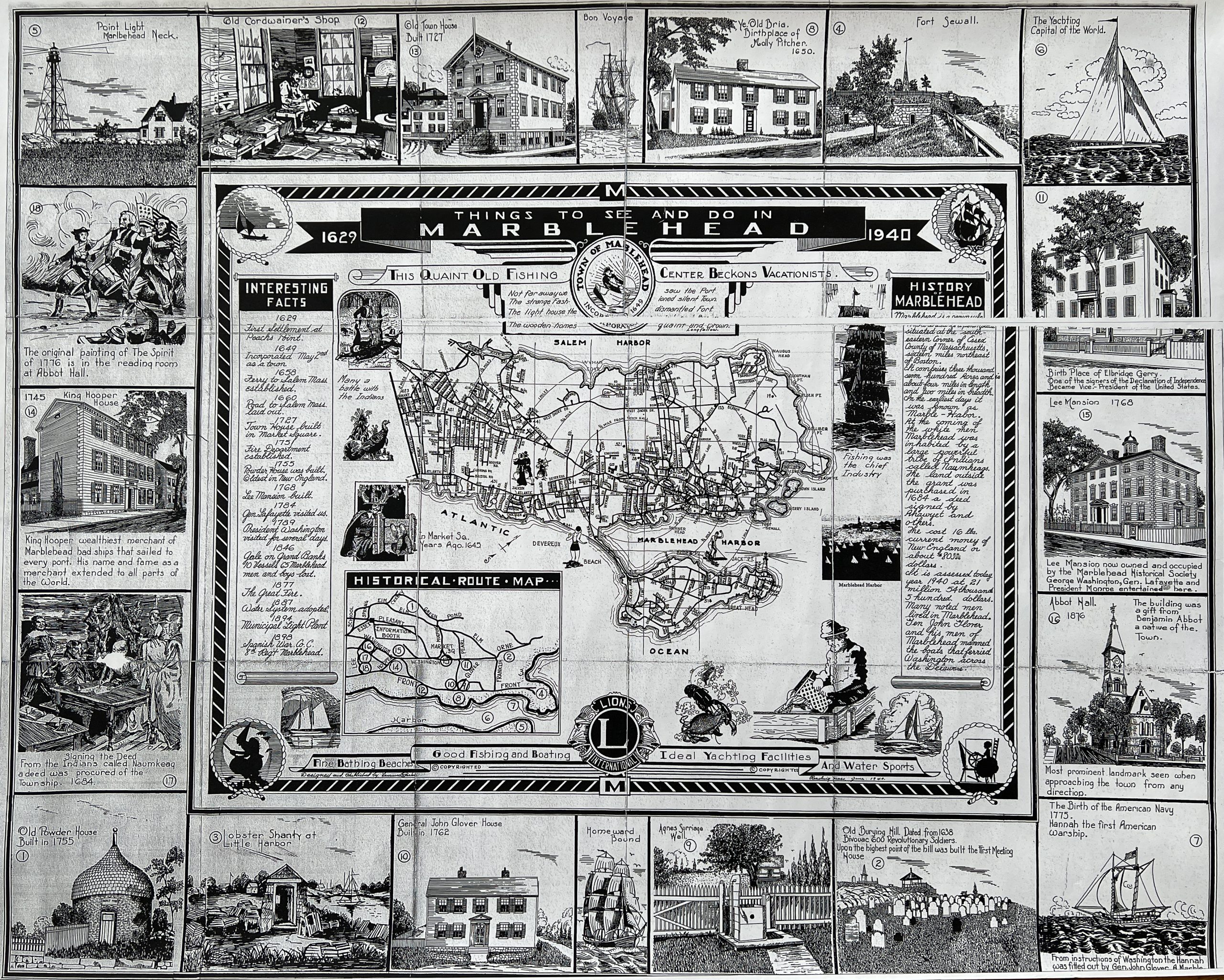
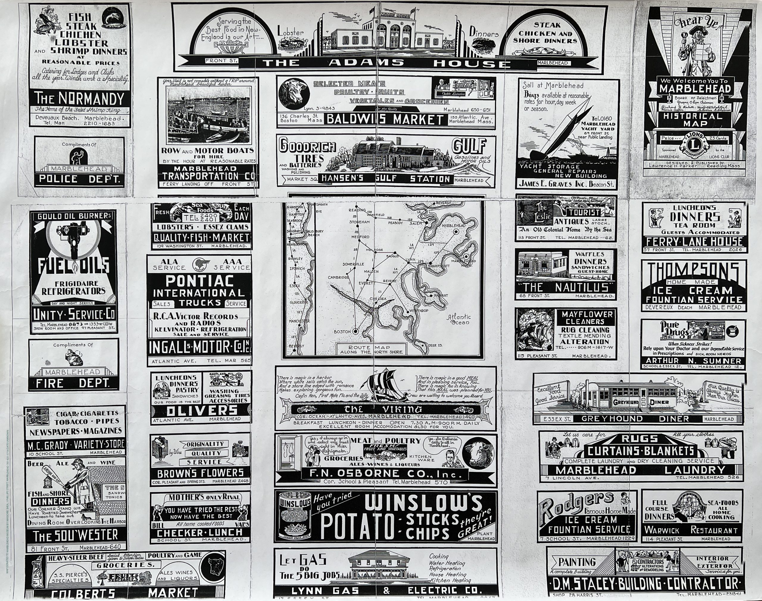
1940 Tourist Motoring Map with Business Advertisements. Click for Part 1 and Part 2.
Further Resources: